Overview
- 21 days / 20 nights
- Moderate
- May - Setember
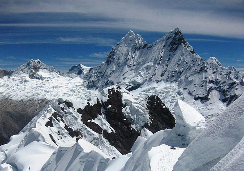
The Cordillera Blanca is the highest equatorial mountain range in the world. With 36 summits rising to over 6000m peaks are perpetually snow – clad. Among the more famous of its mountains are the giant Huascaran (22,300`), the highest peak in Perú -and the classic pyramid of Nevado Alpamayo the world´s most beautiful peak (19,600’). Cold mountain streams tumble and swirl their way down from peaks to the many beautiful glacial “Lakes “. In the canyons called ”Quebrada” only a few thousand feet below, the vegetation ranges from brilliant flowering plants to exotic succulents.
The valleys of the Cordillera Blanca are inhabited by Quechua – speaking Indians. They wear colorful hand loomed woolen clothing and raise corn and potatoes as staple crops. Although there have been some changes due to increasing contact with outsiders, the old traditional way of life is very strong here. Many others still thresh grain by circling donkeys around the floor of the threshing ground; often the work is accompanied by musicians who play wooden flutes and drums.
Few mountain ranges present such varied archeological remains as this one. Artifacts and sites discovered here over the years represent at least four civilizations prior to the Spanish. Abandoned terraces and irrigation systems are testimony to greater agricultural activity in the past.
Mountain trails in the region are good and the hiking is superb, even if you never intend to climb a peak. The weather is usually brilliantly clear and the mountain views are exceptional.
The Cordillera Blanca has become increasingly popular for climbers and trekkers in the last 30 years. The government of Peru made a national park out of most of the Cordillera Blanca in 1975, the purpose of which is to facilitate study of the archeological sites, preserve the rarer species of plants and animals, and to regulate the number of visitors to the area.
Itinerary
Day 1
Arrive Lima at the airport Jorge Chavez in the morning and transfer to the bus station Lima to drive Huaraz. Lima – Huaraz By Tourist Bus Or Private: From Lima 8:30 am, from the city of Lima early eight hours by bus approx. To Huaraz. The first part of the journey that follows a coast of barren desert with evidence of the growing urban population of Peru in several human settlements, passing the cities of Chancay, Huacho, Huaura, in the city of Barranca marine lunch, from the village of Pativilca headed into the mountains, up from 150 m to step Conococha (4100m), we have a first glimpse of snow-capped mountains and mountain Caullaraju (5680 m) and the Cordillera Huayhuash, then we began to descend toward the north to the city of Huaraz (3100m), the heart of the Peruvian Andes. Overnight in hotel – Lunch and dinner.
Day 2
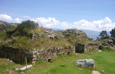
First day of acclimatization Huaraz –Wilcahuain: Huaraz located 3100m capital of the Ancash region and the center of trekking the Cordillera Blanca and Cordillera Huayhuash, Begins in the city of Huaraz visiting the street José Olaya, the only street that remains of Huaraz before the 1970 earthquake, then it ascends to the area Huacrahirca where the Cordillera Blanca seen as the Huandoy mountains Huascaran, Vallunaraju, Churup and Huatsan, follow the path from the lower village of Huanchac, going after the people of Jinua and Paria, visit the pre-Inca temple Ichic Wilcahuain, an architectural complex of the Wari culture (1100 AD) then visit the main temple of Wilcahuain, where we will visit the corridors and buildings as labyrinths of three levels, which are oriented to the fall sun, southern cross and toward the sunrise, we will also visit the small showroom ceramics of this civilization. Later we started the walk towards the town of San Miguel de Recrish from this village began walking downhill to take us 02 hours approx. to the thermal baths of Monterrey, then take a relaxing dip in the swimming pools or the hot springs of healing properties. Return to Huaraz on a bus. Box Lunch and dinner.
It includes:
- Transport. Monterrey.
- Huaraz. Box lunch.
- Ticket payment of sites to visit.
- Official bilingual guide.
Day 3
Second day of acclimatization: Lake Churup: Output private mobility to the east of the city of Huaraz to Pitec, passing the towns of Unchus 3300 m. Llupa village 3500 m. Then we get Pitec 3850 m. From where you have a panoramic view of the central part of the Cordillera Blanca and then started to walk entering the path ascend to the 4450 m, where is located the lagoon Churup beautiful colors called aprox.a 3 hour walk, on the way some rocky areas scale. The Laguna Churup is a classic destination in Huaraz to acclimatize, then return to the city of Huaraz. End of our service. Box Lunch and dinner.
It includes:
- Huaraz.
- Pitec Transport Huaraz.
- Box lunch.
- Ticket payment of sites to visit.
- Official bilingual guide.
Day 4
Huaraz – Cashapampa – Llamacorral.
Duration: 4 hours drive and 4/5hrs hike. Approx.
Journey to the north of Huaraz, in the journey you can appreciate landscapes and cities of the Callejon de Huaylas, near the holy river, the first stop is in the village of Anta to photograph the mountains of Huandoy, Huascaran, Chopicalqui, Copa, Urus and Vallunaraju, continuing the tour through the villages of Marcara, Acopampa then we will have our second stop in the city of Carhuaz, which is characterized by its traditional customs and traditional dress, they visit the square and the church St. Peter and delight the rich ice cream made of typical fruits of Carhuaz and the valley of Huaylas. The trip continues north and visit the ancient city of Yungay (2500 m), this city disappeared after the earthquake by an avalanche of Nevado Huascaran on May 31, 1970, now called holy field of Yungay, in this place alone remained as silent witnesses to this tragedy 04 palm trees and white image of christ on the top of the cemetery. Currently the new city of Yungay is located 1 km.. North of the cemetery. From Caraz started to climb to the village of Cashapampa (2990 m) We immediately started with the trek/walk up the narrow Santa ruz valley. This is the fist part of one of the most famous treks in Perù. The Santa Cruz – Llanganuco Circuit. As we gain height the valley opens out and more snowy peaks emerge onto the skyline. We camp at the small lake of Ichic Cocha(Llamacorral) 3800m 5/6 hrs. (L.D).
Day 5
Llamacorral – Base camp of Alpamayo (4200m): Continuing up the Santa Cruz valley to the peaks of Alpamayo , Quitaraju, and the amazing rock and ice towers of Taulliraju gradually dominate the view. The valley becames a sea of lupins. 4/5 hrs. (B,L,D)
Day 6
Base camp to Moraine camp.(4900m). From here we have to carry our own equipment which is the most pronounced an stige to brown camp. Little by little it brings us closer to the Alpamayo glacier. Today it is comfortable as acclimatization during the morning to Camp Moraine, after a good panorama in front of Nevado Artezonraju, we return to base camp and sleep here, this is an acclimatization to get used to the height. (B, L, D)
Day 7
Base camp to Morena camp. Breakfast in camp and after an early lunch we go up to Camp Moraine, by the same path we climbed as acclimatization and we sleep in Camp Moraine. (B, L, D)
Day 8
Moraine camp to High camp of Alpamayo (5600mm). From camp moraine we begin our ascent to enter the glacier and climb the saddle, here we have to cross a crack. The next large glacial basin, the second Alpamayo high camp is built. From here we have an excellent view of the ice face of Alpamayos. (B, L, D)
Day 9
High camp to Summit of Alpamayo (5947m). At night boarding is done on the southwest wall of the glacier-rich Alpamayos crevasse. The first thing we need to overcome the crack, you can also, depending on the conditions present difficulties. At about 400m the long and steep headland increases -50-60* steep reefs leis wall to the roughness of the summit. On a very fine line to reach the top of the exposed Alpamayos here we enjoy a spectacular view of the neighboring peaks of the Cordillera Blanca.
Return from the summit to high camp and immediately pack up the luggage and descend to base camp, a very hard and exhausting day, but very happy. (B, L, D)
Day 10
We can consider a reserve day, if it is bad weather or Climb to Quitaraju.(6036m) (B, L, D)
Day 11
Base camp to Cashapampa – Huaraz – Hotel. The descent from base camp takes place through the vast Santa Cruz Valley to cashapampa. From here we will return with our bus that is waiting for us in cashapampa and will take us to Huaraz – Hotel, to hot showers and a celebratory night out on the town. (B, L, D).
Day 12
Rest day in Huaraz, after a hard day climbing Alpamayo, but very happy and also preparing equipment for another climb of Huascaran.
Huascaran Itinerary
Day 13
We leave from Huaraz at about 8 am for the start of the main climbing. The bus takes us to Musho at the other end of the range; a journey of 3-4 hours. As the road is parallel to the mountains the views are quite spectacular. The final climb to our Village of Musho is up a winding mounrain road, and the bus leaves us with the tents, food and our gear for the next 7 days on Climbing. Musho (3,030m) (L, D)
Musho to Base camp. Arrange for donkeys and donkey drivers, From the plaza to carry our loads to base camp.
Departing Musho for Huascaran follow the main Street out of town in the direction of Huascaran. This road Will wind through Farmer`s fields for about one kilometer before turning off to the south. Now take a wide path that leads directly toward the mountain and through some eucalyptus platations. This wide Trail zigzzgs up a long steep hillside to the crest o fan old moraine ridge. After following the ridge, the Trail then traverses right towaed a quenual grove and then zigzags up the hillside through the trees to bring you to Huascaran base camp at 4,150m (3 – 4 Hrs) walk from Musho.(B, L, D)
Day 14
The route from the base camp to moraine camp climbs a 6m rock step, then follows cairs in a traverse to the south (right), across a system of ledges with an occasional climb up to the next ledge system. Moraine camp is located at about 4900m, on rock slabs 200m below the Edge of the glacier, next to a stream (1- 1/2- ½ hrs ; if you are fit, acclimatized and traveling light, you could go from Musho all the way to moraine camp in 7-8 hours. 4900m. (B. L, D)
Day 15
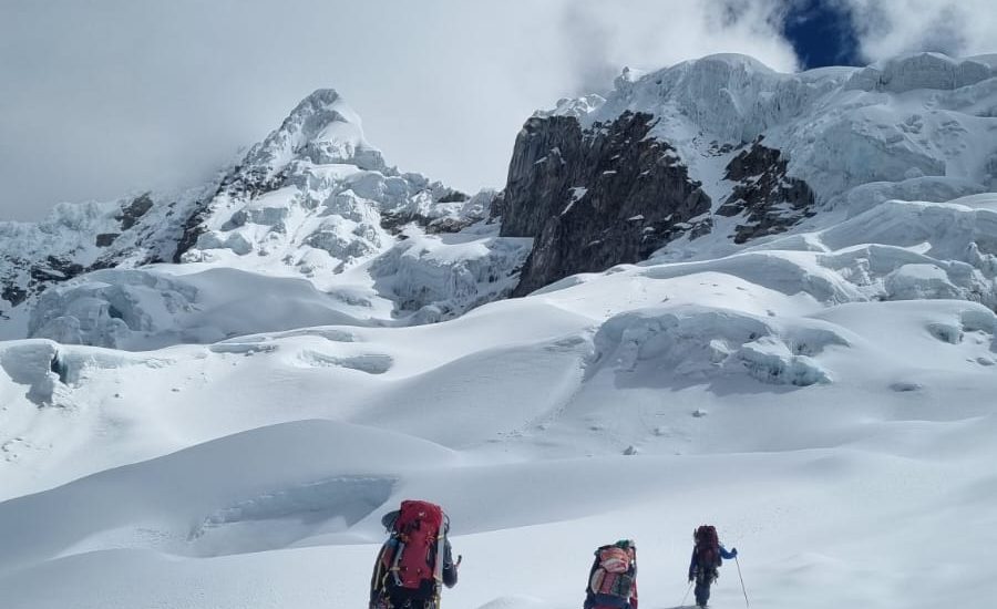
From the moraine camp, several cairned trails climb straight up the slabs, to reach the edge of the glacier (1. ½ hrs). The route on the glacier is straightforward. Crevasses are easy to see and avoid, although it is wise to put on your crampons. Camp 1 is locted at 5400m on the broad glacier, out of harm`s way from serac fall (1-2 hrs).
The route to camp 2 is the most dangerous part of the ascent, due to the prolonged exposure to posible serac avalanches. Traveling light is advised. If you aren`t well acclimatized, making two light carries to camp 2 would not only help you to move quickly, it would help you to acclimatize more gradually.(B, L, D)
Day 16
From camp 1. wander 300m up the glacier, toward the área called the Candeletta, Lying between two serac zones, this 200m, 35- to 40- degree hourglass-shaped gully must be ascended before traversing to the garganta . There are usually two big crevasses that can be difficult to cross. You may have to climb 70- to 80-degree ice, up the wall on the far sude of the crevasses. Fixing a short rope can be helpful.
Once at the top of the candeletta (5800m), make a rising traverse left, toward the garganta, passing beneath two large serac zones. (It Will be obvious where the need to Harry is.) Just beneath the garganta, several gigantic crevasses span almost the entire width of the col. Normally, the best way around these is at the far leaft (north) end. Make camp on the west Edge of the col, out of danger from avalanches (Camp 6000m), 4-6 hours.(B, L, D)
Day 17
The Word garganta means “throat” and is used to describe the deep trough between Huascaran`s north and south peaks. Lying in the garganta, camp 2 is a cold, windy place. Most parties start at 2 am. In order to reach the Summit ( 6768m) just after sunrise, At the summit of Huascaran the panorama is incredible, all the summits around the Cordillera Blanca can be seen, so we Will have plently of time to descend to camp tow, pack up and descend to moraine camp, on the same day.
Begin the route to the Summit by walking across the broad, flat col, toward the north slopes of Huascaran Sur. Take the easiest way up these slopes, Usually, after climbing the first 250m of 40- to 45-degree slopes above the col, the route is just a long walk to the top However, a rope is still a Good ide, because there are crevasses all the way to the Summit . More tan one person has died after fallong into a hidden creasse near the Summit. Time 4-6 hours; 6 -7 days round trip from Huaraz, if you are well acclimatized and traveling light. (B; L; D)
Day 18
We can consider a reserve day, if it is bad weather. (B, L, D)
Day 19
From moraine camp to Base camp down on the same way we climb up at the begining and down to Musho and drive back to Huaraz.- Hotel
We started to go down from base camp towards Musho.
From here we started going down through the trees and the small ridge and then ziczag down and then we came out onto a wide path with a long slope and likewise through the eucalyptus plantations.
This road meanders through agricultural fields for about 1 kilometer down towards Musho, from here we continue down towards Musho, and from here we arrive at the streets of Musho town, where our vehicle is waiting for us to take us. to Huaraz. Hotel, to hot showers and a celebratory night out on the town. (B, L,)
Day 20
The long return bus ride to Lima. Usually a lively ride with re-oxygenating blood, a sense of achievement, relaxation and a welcome rest from activity. The trip ends back in Lima. If there is time before your return flight, explore the city (with care!), visit the gold museum or the Catacombs or shop for a few last minute wall hangings! (B)
Day 21
Depart Jorge Chavez International, Lima Airport and flight back home.
Included
- Personalized service to customers with bilingual at the airport and in the city of Lima guides.
- Helpdesk pick up and transfer to Lima's Jorge Chavez International Airport. Airport Hotel chosen.
- Assisting customers with transfer person, the hotel to the bus station and visiversa in Lima and Huaraz.
- City tour in Lima if customers require
- Private bus Lima - Huaraz - Lima.
- Transport during the days of acclimatization.
- Transport. to the point of beginning of the Trek and pick the end of trek. Huaraz-Hotel
- Bus ticket. Lima - Huaraz-Lima. individual customers.
- Logistic Team during the trek.
- Official bilingual guide for the trek (Castilian, English).
- Official Guide UIAGM high mountain (Castilian, English) certification.
- Cook with extensive experience and high mountain trek.
- Assistants with extensive experience.
- Horsemen and donkeys (10 kilos of luggage, personal clothing and equipment trek).
- Box lunch / hot lunch.
- Full meals as breakfast, snack, lunch and dinner during the trek (vegetarian option).
- Dining tent, kitchen, bathroom and shower tent.
- Tables, chairs with a backrest and lamp room.
- Kitchen and all kitchen amenities.
- Personal tents and personal bi, high quality. Harwear Mountain, North face, Vaude and Salewa and Newfoundland. Etc.
- Air mattress and sleeping mats
- Basic first aid kit.
- Certec Bag, camera iper barrel in case of emergency, for customers who suffer altitude sickness that can withstand hours or days / Oxygen.
- Emergency horse to evacuate customers if necessary.
- Payment of entrance fees to places to visit in Huascaran National Park.
- Nights hotel in Lima and Huaraz.
Not Included
- Extra Hotels in Huaraz and Lima.
- Extra Meals
- Laundry
- Extra Tours in Lima and Huaraz.
- Extra Tips at airport and trek.
- Alcoholic drinks
- Craft.
- Sleeping bag.
- Life insurance while in Trek / Peru
- Personal specific medicines.
- Airport tax in / outbound flights.
- Domestic flights in Peru.
- Extra transfers in Lima and Huaraz.


