
Overview
- 09 days / 08 nights
- Moderate
- May - Setember
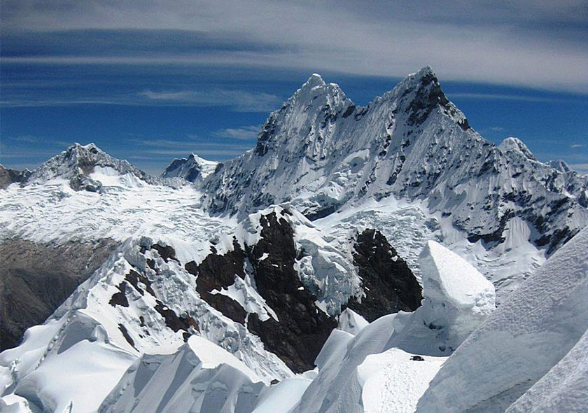
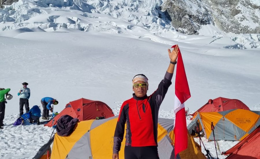
The Cordillera Blanca is the highest equatorial mountain range in the world. With 36 summits rising to over 6000m peaks are perpetually snow – clad. Among the more famous of its mountains are the giant Huascaran (22,300`), the highest peak in Perú -and the classic pyramid of Nevado Alpamayo the world´s most beautiful peak (19,600’). Cold mountain streams tumble and swirl their way down from peaks to the many beautiful glacial “Lakes “. In the canyons called ”Quebrada” only a few thousand feet below, the vegetation ranges from brilliant flowering plants to exotic succulents.
The valleys of the Cordillera Blanca are inhabited by Quechua – speaking Indians. They wear colorful hand loomed woolen clothing and raise corn and potatoes as staple crops. Although there have been some changes due to increasing contact with outsiders, the old traditional way of life is very strong here. Many others still thresh grain by circling donkeys around the floor of the threshing ground; often the work is accompanied by musicians who play wooden flutes and drums.
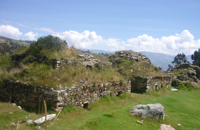
Few mountain ranges present such varied archeological remains as this one. Artifacts and sites discovered here over the years represent at least four civilizations prior to the Spanish. Abandoned terraces and irrigation systems are testimony to greater agricultural activity in the past.
Mountain trails in the region are good and the hiking is superb, even if you never intend to climb a peak. The weather is usually brilliantly clear and the mountain views are exceptional.
The Cordillera Blanca has become increasingly popular for climbers and trekkers in the last 30 years. The government of Peru made a national park out of most of the Cordillera Blanca in 1975, the purpose of which is to facilitate study of the archeological sites, preserve the rarer species of plants and animals, and to regulate the number of visitors to the area.
Itinerary
Day 1
We leave from Huaraz at about 8 am for the start of the main climbing. The bus takes us to Musho at the other end of the range; a journey of 3-4 hours. As the road is parallel to the mountains the views are quite spectacular. The final climb to our Village of Musho is up a winding mounrain road, and the bus leaves us with the tents, food and our gear for the next 7 days on Climbing. Musho (3,030m) (L, D)
Musho to Base camp. Arrange for donkeys and donkey drivers, From the plaza to carry our loads to base camp.
Departing Musho for Huascaran follow the main Street out of town in the direction of Huascaran. This road Will wind through Farmer`s fields for about one kilometer before turning off to the south. Now take a wide path that leads directly toward the mountain and through some eucalyptus platations. This wide Trail zigzzgs up a long steep hillside to the crest o fan old moraine ridge. After following the ridge, the Trail then traverses right towaed a quenual grove and then zigzags up the hillside through the trees to bring you to Huascaran base camp at 4,150m (3 – 4 Hrs) walk from Musho.
Day 2
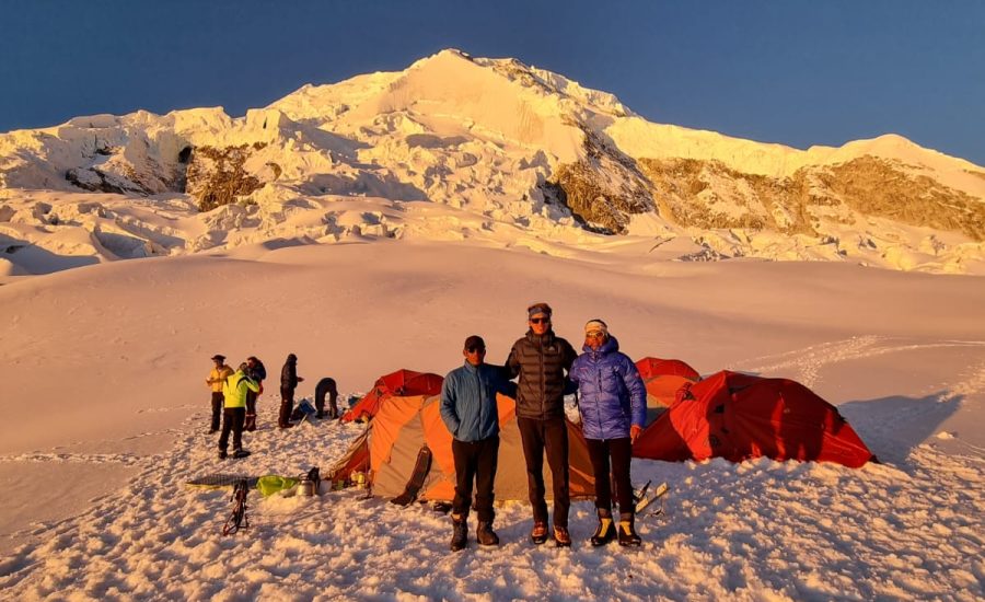
The route from the base camp to moraine camp climbs a 6m rock step, then follows cairs in a traverse to the south (right), across a system of ledges with an occasional climb up to the next ledge system. Moraine camp is located at about 4900m, onrock slabs 200m below the Edge of the glacier, next to a strm (1- 1/2- ½ hrs ; if you are fit, acclimatized and traveling light, you could go from Musho all the way to moraine camp in 7-8 hours. 4900m. (B. L, D)
Day 3
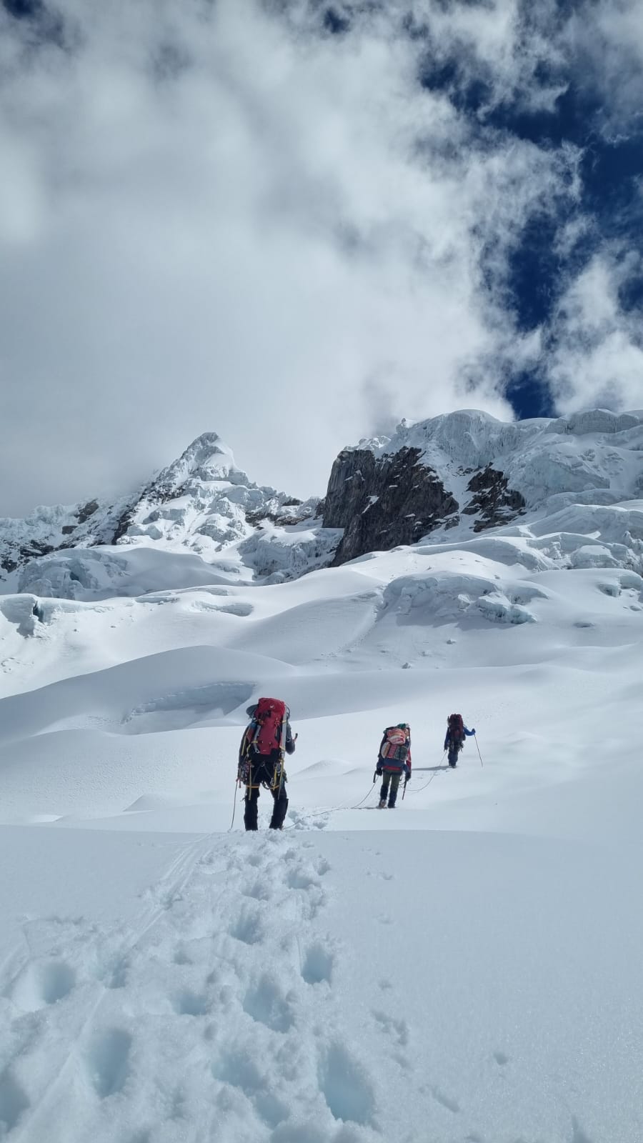
From the moraine camp, several cairned trails climb straight up the slabs, to reach the edge of the glacier (1. ½ hrs). The route on the glacier is straightforward. Crevasses are easy to see and avoid, although it is wise to put on your crampons. Camp 1 is locted at 5400m on the broad glacier, out of harm`s way from serac fall (1-2 hrs).
The route to camp 2 is the most dangerous part of the ascent, due to the prolonged exposure to posible serac avalanches. Traveling light is advised. If you aren`t well acclimatized, making two light carries to camp 2 would not only help you to move quickly, it would help you to acclimatize more gradually.
Day 4
From camp 1.- wander 300m up the glacier, toward the área called the Candeletta, Lying between two serac zones, this 200m, 35- to 40- degree hourglass-shaped gully must be ascended before traversing to the garganta . There are usually two big crevasses that can be difficult to cross. You may have to climb 70- to 80-degree ice, up the wall on the far sude of the crevasses. Fixing a short rope can be helpful.
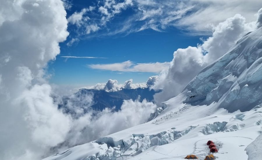
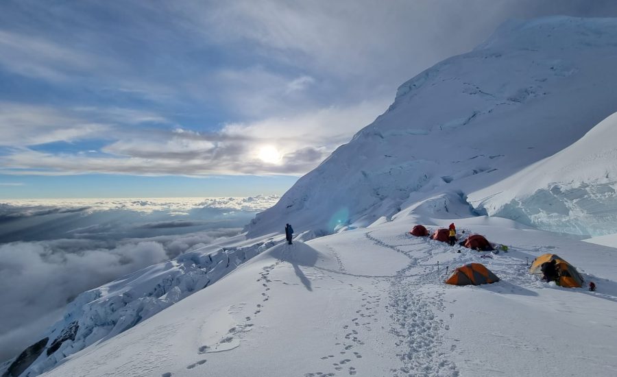
Once at the top of the candeletta (5800m), make a rising traverse left, toward the garganta, passing beneath two large serac zones. (It Will be obvious where the need to Harry is.) Just beneath the garganta, several gigantic crevasses span almost the entire width of the col. Normally, the best way around these is at the far leaft (north) end. Make camp on the west Edge of the col, out of danger from avalanches (Camp 6000m), 4-6 hours)
Day 5
We can consider a reserve day, if it is bad weather. (B, L, D)
Day 6
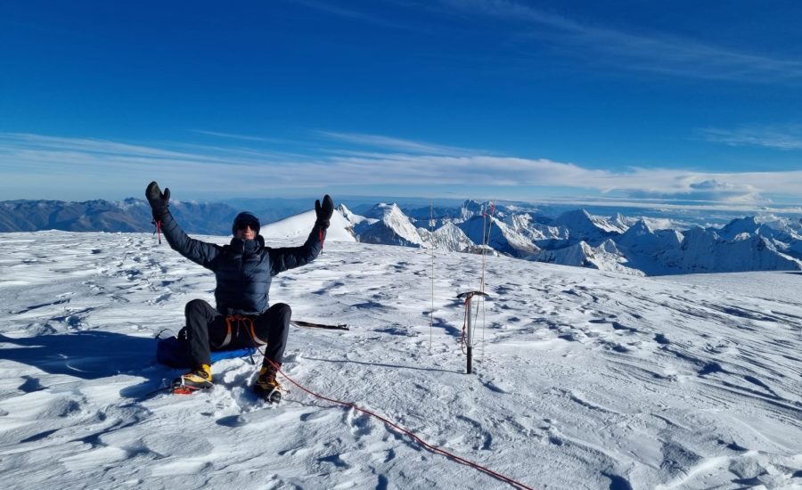
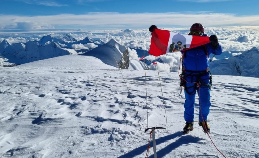
The Word garganta means “throat” and is used to describe the deep trough between Huascaran`s north and south peaks. Lying in the garganta, camp 2 is a cold, windy place. Most parties start at 2 am. In order to reach the Summit ( 6768m) just after sunrise, en la cumbre de Huascaran es increíble la panorama toda las cumbres de Cordillera Blanca se puede ver, so we Will have plently of time to descend to camp to, pack up and descend to moraine camp, on the same day.
Begin the route to the Summit by walking across the broad, flat col, toward the north slopes of Huascaran Sur. Take the easiest way up these slopes, Usually, after climbing the first 250m of 40- to 45-degree slopes above the col, the route is just a long walk to the top However, a rope is still a Good ide, because there are crevasses all the way to the Summit . More tan one person has died after fallong into a hidden creasse near the Summit. Time 4-6 hours; 6 -7 days round trip from Huaraz, if you are well acclimatized and traveling light.
Day 7
From moraine camp to Base camp down on the same way we climb up at the begining and down to Musho and drive back to Huaraz.- Hotel
We started to go down from base camp towards Musho.
From here we started going down through the trees and the small ridge and then ziczag down and then we came out onto a wide path with a long slope and likewise through the eucalyptus plantations.
This road meanders through agricultural fields for about 1 kilometer down towards Musho, from here we continue down towards Musho, and from here we arrive at the streets of Musho town, where our vehicle is waiting for us to take us. to Huaraz. Hotel, to hot showers and a celebratory night out on the town. (B, L,)
Day 8
The long return bus ride to Lima. Usually a lively ride with re-oxygenating blood, a sense of achievement, relaxation and a welcome rest from activity. The trip ends back in Lima. If there is time before your return flight, explore the city (with care!), visit the gold museum or the Catacombs or shop for a few last minute wall hangings! (B)
Day 9
Depart Jorge Chavez International, Lima Airport and flight back home.
Included
- Personalized service to customers with bilingual at the airport and in the city of Lima guides.
- Helpdesk pick up and transfer to Lima's Jorge Chavez International Airport. Airport Hotel chosen.
- Assisting customers with transfer person, the hotel to the bus station and visiversa in Lima and Huaraz.
- City tour in Lima if customers require
- Private bus Lima - Huaraz - Lima.
- Transport during the days of acclimatization.
- Transport. to the point of beginning of the Trek and pick the end of trek. Huaraz-Hotel
- Bus ticket. Lima - Huaraz-Lima. individual customers.
- Logistic Team during the trek.
- Official bilingual guide for the trek (Castilian, English).
- Official Guide UIAGM high mountain (Castilian, English) certification.
- Cook with extensive experience and high mountain trek.
- Assistants with extensive experience.
- Horsemen and donkeys (10 kilos of luggage, personal clothing and equipment trek).
- Box lunch / hot lunch.
- Full meals as breakfast, snack, lunch and dinner during the trek (vegetarian option).
- Dining tent, kitchen, bathroom and shower tent.
- Tables, chairs with a backrest and lamp room.
- Kitchen and all kitchen amenities.
- Personal tents and personal bi, high quality. Harwear Mountain, North face, Vaude and Salewa and Newfoundland. Etc.
- Air mattress and sleeping mats
- Basic first aid kit.
- Certec Bag, camera iper barrel in case of emergency, for customers who suffer altitude sickness that can withstand hours or days / Oxygen.
- Emergency horse to evacuate customers if necessary.
- Payment of entrance fees to places to visit in Huascaran National Park.
- Nights hotel in Lima and Huaraz.
Not Included
- Extra Hotels in Huaraz and Lima.
- Extra Meals
- Laundry
- Extra Tours in Lima and Huaraz.
- Extra Tips at airport and trek.
- Alcoholic drinks
- Craft.
- Sleeping bag.
- Life insurance while in Trek / Peru
- Personal specific medicines.
- Airport tax in / outbound flights.
- Domestic flights in Peru.
- Extra transfers in Lima and Huaraz.